A landscape response to the site infrastructure constraints that shape his program and identity
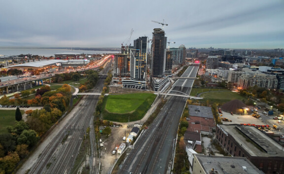
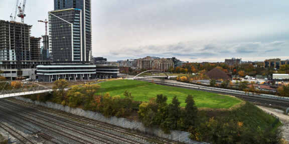
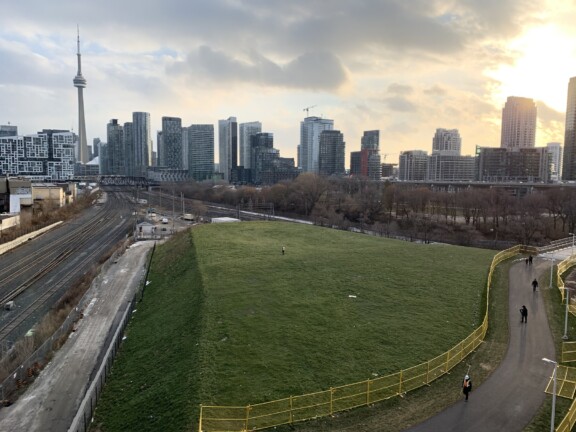
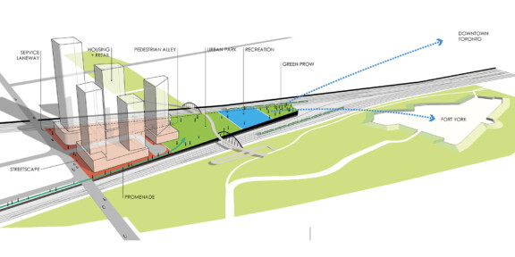
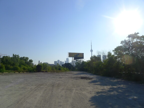
West of downtown Toronto and north of Fort York currently lies the Ordnance Triangle – an abandoned and obscure post-industrial 9 acres terrain bounded by Strachan Avenue to the west and the merger of two major CP, CN, Metrolinx, and GO Transit rail corridors to the east. The constraint imposed on the triangular site by these two rail corridors contributes to the site’s most phenomenal quality – a long elevated and unobstructed view axis to the heart of Toronto’s downtown skyline.
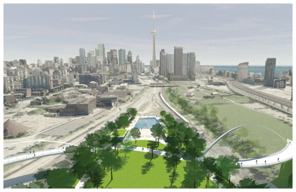
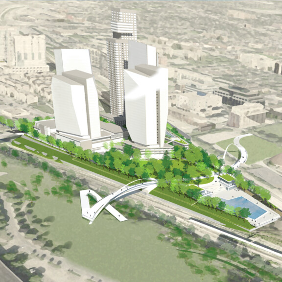
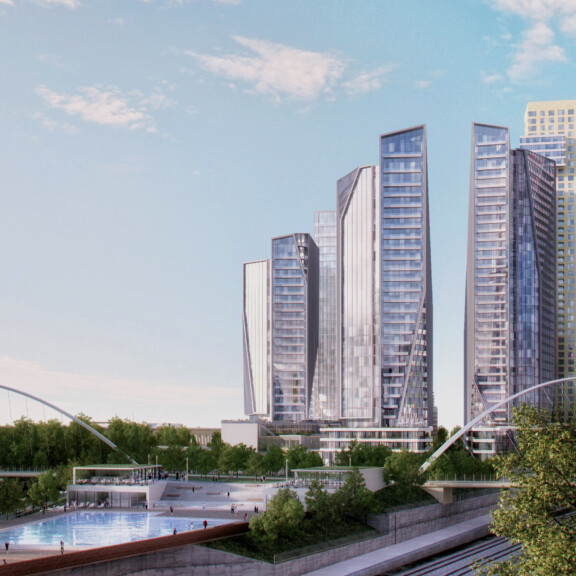
Garrison Point is poised to become a fundamental link in the city. Two signature pedestrian bridges proposed by the City of Toronto will span over both rail corridors, essentially linking the Queen West neighbourhoods to the north with Fort York and the Toronto waterfront to the south.
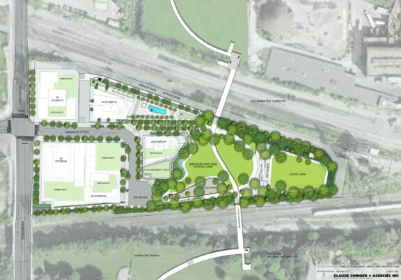
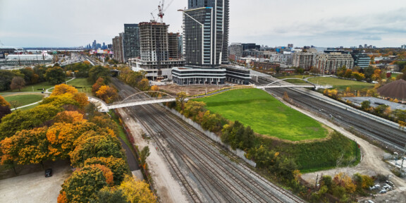
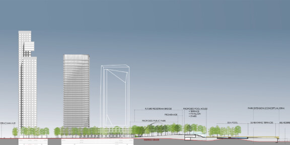
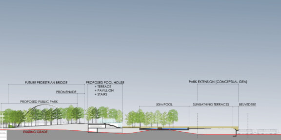
The density of this mixed-use residential and commercial development composed of 5 towers is balanced by a large forested public open space. A thoughtful cut and fill strategy that recycles excavated building soil will be used to raise the site topography to the level of the elevated footbridges, which at the same time will create a promontory with panoramic views to the city.
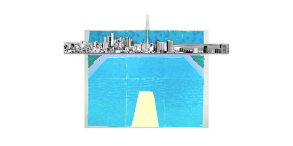
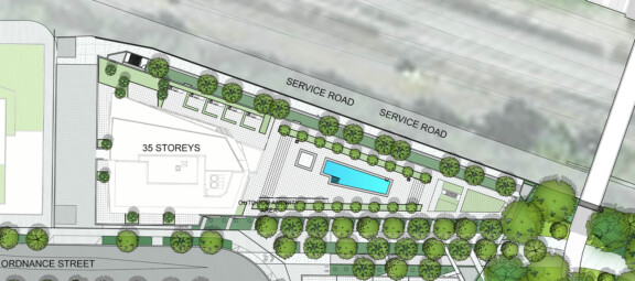
Tracing the highest point in the park is the pathway between the two bridges. A forested slope gradually descends westward towards Strachan Avenue, spilling onto the streetscape to establish an inviting park threshold. East of the pathway, a grand staircase between two restaurant pavilions steps down towards a large outdoor 50m public swimming pool with infinity urban edge positioned to capture the mirage-like urban horizon on its reflected surface.
