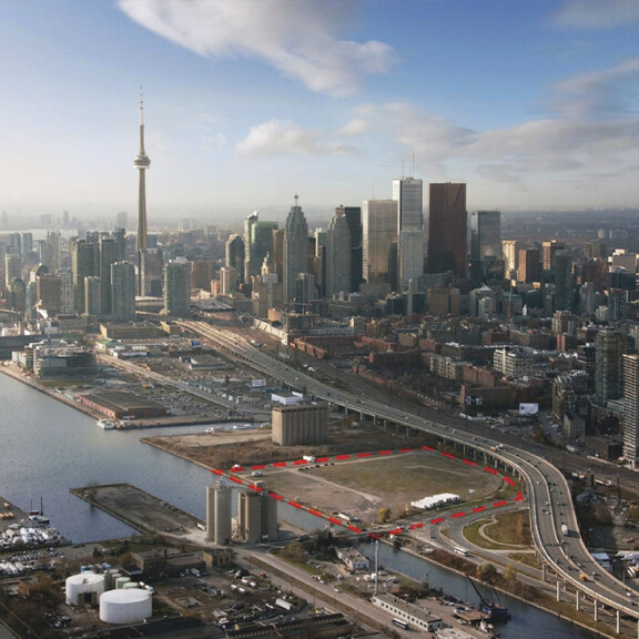
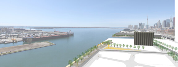
Located on Lake Ontario in downtown Toronto, the 5.5 hectare (13.5 acre) 3C Waterfront site will be transformed into a sustainable waterfront destination—an innovative mixed-use community, which will be grounded by a vibrant public realm. The development proposal will support approximately 2.4 million square feet of residential, commercial, office, retail, and cultural space, as well as a significant amount of publicly accessible open space.
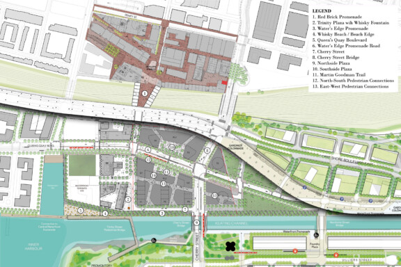
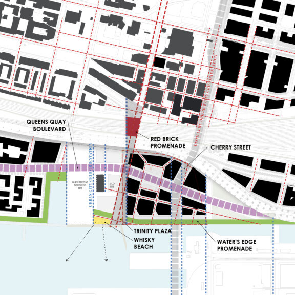
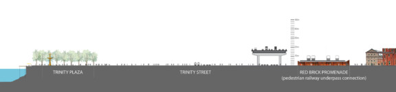
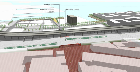
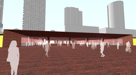
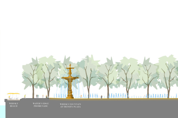
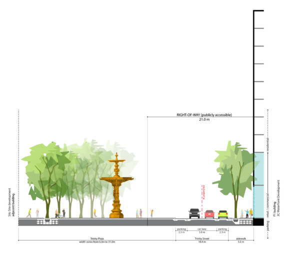
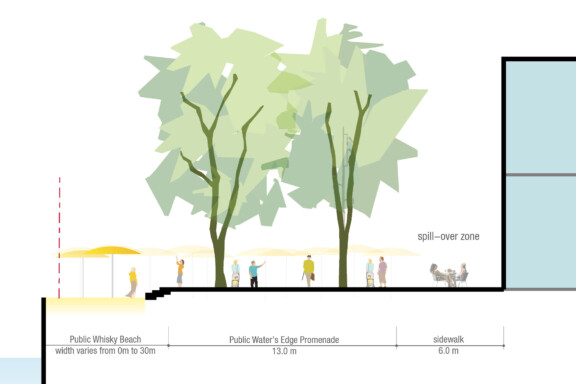
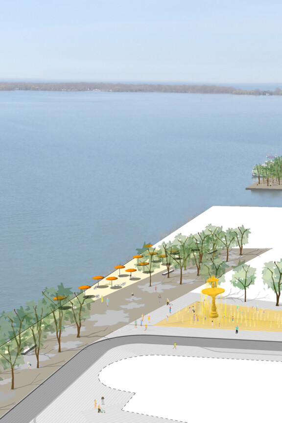
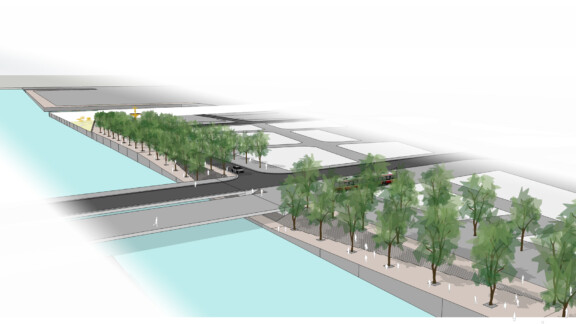
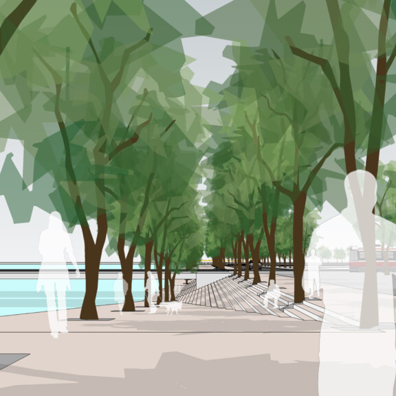
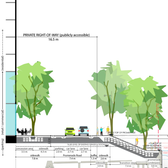
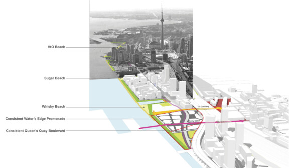
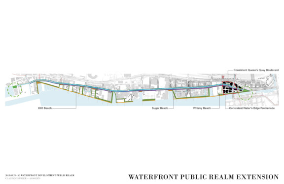
The 3C Waterfront development proposes a dynamic and unique public realm program. A few elements of the public realm program include: a central plaza, which will connect the lands north and south of the future Queens Quay Boulevard; a water’s edge promenade; pedestrian railway underpass connection at Trinity Street (known as the Red Brick Promenade) and a series of fine-grained pedestrian only streets lined with shops and cafés. Further, working with the adjacent silo property to the west, an urban beach along the water’s edge and a large civic space at the foot of Trinity Street accented by the giant interactive amber-coloured Whisky Fountain is also proposed.
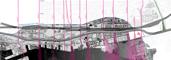
3C Waterfront’s proposed public realm plan reinforces the singular urban design vision established for the entire breadth of the downtown Toronto waterfront, while marking an important gateway to what will become the revitalized Port Lands.
The 3C Waterfront team has presented the following concept plans/materials at the December 14, 2011 Waterfront Design Review Panel meeting and at the February 27, 2012 community update meeting.